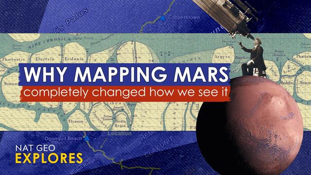
Mars Mapmakers' Rivalry: A History Of Martian Cartography

Discover more detailed and exciting information on our website. Click the link below to start your adventure: Visit Best Website. Don't miss out!
Table of Contents
Mars Mapmakers' Rivalry: A History of Martian Cartography
For centuries, humanity has gazed at Mars, a fiery red dot in the night sky, fueling imaginations and inspiring countless science fiction tales. But beyond the myths and legends lies a fascinating history of scientific endeavor: the creation of Martian maps. This journey, however, wasn't a collaborative effort; it was marked by a spirited rivalry, a race to accurately chart the surface of our neighboring planet. This article delves into the intriguing history of Martian cartography, exploring the key players and their contributions to our understanding of the Red Planet.
The Early Days: Speculation and Telescopic Observations
Early Martian maps were, understandably, rudimentary. Limited by the technology of the time, 17th and 18th-century astronomers relied heavily on telescopic observations, resulting in maps that were more artistic interpretations than scientific representations. Key features like canals, often depicted prominently, were later proven to be optical illusions, highlighting the challenges of early Martian observation. This era showcases the limitations of early technology and the inherent biases in interpreting visual data from such a distance.
Schiaparelli and Lowell: The "Canals" Controversy
Giovanni Schiaparelli, a renowned Italian astronomer, is often credited with igniting the "canals" controversy in the late 19th century. His observations, while meticulously recorded, led to interpretations of linear features on Mars, which he termed "canali" – Italian for "channels." This word, unfortunately translated as "canals" in English, fueled speculation about artificial waterways and even intelligent life on Mars.
- Schiaparelli's meticulous drawings formed the basis of many subsequent maps.
- Percival Lowell, a wealthy American astronomer, seized upon Schiaparelli's work, publishing influential books and maps depicting an elaborate network of canals built by Martians. Lowell's influential work, while ultimately inaccurate, profoundly impacted public perception of Mars.
The Space Age: A New Era of Martian Mapping
The launch of space probes in the mid-20th century revolutionized Martian cartography. The Mariner and Viking missions provided the first close-up images, revealing a vastly different landscape than the one imagined by Lowell and his contemporaries. These missions delivered high-resolution imagery, allowing for the creation of much more accurate maps. This transition marked a shift from speculative cartography to data-driven, scientifically rigorous mapping.
Modern Martian Cartography: High-Resolution and Global Views
Today, Martian mapping relies on a wealth of data from orbiters like Mars Reconnaissance Orbiter (MRO) and Mars Global Surveyor (MGS). These spacecraft utilize advanced technologies like high-resolution cameras and radar, creating incredibly detailed maps that reveal surface features with unprecedented clarity. This data has not only improved our understanding of Mars' geology and topography but has also played a crucial role in selecting landing sites for robotic missions and planning future human exploration.
- Digital Elevation Models (DEMs): Provide three-dimensional representations of the Martian terrain.
- Spectral Imaging: Allows scientists to identify different minerals and rock types.
- Open-source data: Agencies like NASA make much of this data publicly available, fostering collaboration and further research.
The Ongoing Quest: Unveiling the Secrets of Mars
The rivalry between early Martian mapmakers, driven by limited technology and ambitious interpretations, ultimately contributed to our current understanding. While their initial maps were inaccurate, they spurred further investigation and laid the groundwork for the sophisticated cartography we have today. The ongoing exploration of Mars promises even more detailed maps and a deeper understanding of our planetary neighbor, all building upon the legacy of those early pioneers who dared to map the unknown. Learn more about current Mars missions and future exploration plans by visiting NASA's website!

Thank you for visiting our website wich cover about Mars Mapmakers' Rivalry: A History Of Martian Cartography. We hope the information provided has been useful to you. Feel free to contact us if you have any questions or need further assistance. See you next time and dont miss to bookmark.
Featured Posts
-
 Find Every Oscar Nominated Movie To Stream Now
Jan 25, 2025
 -
 Public Health Warning Botulism Cases Confirmed In Sydney Hospitals
Jan 25, 2025
 -
 Fastest Underwater Acceleration Young Shrimps Tiny Claws
Jan 25, 2025
 -
 Hildeby Reassigned Leafs Recall Veteran Goalie Murray
Jan 25, 2025
 -
 Atitude Polemica Por Que Jojo Carosella E Marquezine Intimidam
Jan 25, 2025
Latest Posts
-
 Hall Green Stabbing 14 Year Old Boy To Face Murder Charges
Jan 27, 2025
 -
 700 Jobs Cut As Bridgestone Shuts Down Tennessee Facility
Jan 27, 2025
 -
 Kekalahan Tottenham Leicester City Perpanjang Rentetan Negatif
Jan 27, 2025
 -
 Die Koblenz Open Spannende Spiele Und Starke Leistungen
Jan 27, 2025
 -
 27
Jan 27, 2025