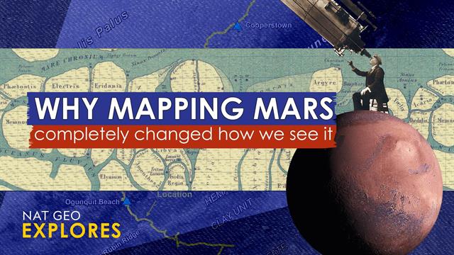
The Feuding Cartographers Who Defined Our Mars Obsession

Discover more detailed and exciting information on our website. Click the link below to start your adventure: Visit Best Website. Don't miss out!
Table of Contents
The Feuding Cartographers Who Defined Our Mars Obsession
For decades, Mars has captivated our imaginations, fueling dreams of exploration and colonization. But before the rovers and orbiters, before the breathtaking images beamed back to Earth, our understanding of the Red Planet was shaped by the painstaking work – and bitter rivalry – of a handful of dedicated cartographers. Their feuds, rivalries, and competing maps not only defined our early understanding of Mars but also ignited a public obsession that continues to this day.
This isn't just a story about maps; it's a story about ambition, scientific rigor, and the human element that often colors even the most objective pursuits. It's a tale of how the quest to understand Mars mirrored the complexities and conflicts inherent in human endeavor.
The Dawn of Martian Cartography: Schiaparelli and Lowell's Competing Visions
The late 19th and early 20th centuries witnessed a surge in Martian observation. Giovanni Schiaparelli, an Italian astronomer, meticulously charted the Martian surface, famously observing what he termed "canali." While he used the Italian word for "channels," the term was mistranslated as "canals" in English, sparking intense speculation about artificial waterways and a technologically advanced Martian civilization. This misinterpretation fueled the public's fascination with Mars and significantly influenced early Martian cartography.
Schiaparelli's maps, while initially groundbreaking, lacked the precision we expect today. His work, however, served as the foundation upon which Percival Lowell built his own, more controversial interpretations.
Lowell's Canals and the Martian Mania
Percival Lowell, a wealthy American astronomer, seized upon Schiaparelli's observations, expanding on the "canal" theory. He published several influential books, vividly depicting Mars as a dying planet inhabited by a struggling civilization desperately engineering canals to manage dwindling water resources. Lowell's compelling narrative, coupled with his considerable financial resources and skilled promotion, ignited a worldwide Mars mania.
Lowell Observatory, founded by Lowell himself, became a center for Martian observation. However, his interpretations were increasingly challenged by other astronomers who argued that the "canals" were an optical illusion, a product of the limitations of early telescopic technology.
The Rise of Photographic Mapping and the Demise of the Canals
The advent of astrophotography revolutionized Martian cartography. High-resolution images gradually revealed the true nature of the Martian surface, dispelling the myth of the artificial canals. While Lowell's maps held a significant place in popular culture, they were ultimately proven inaccurate. The scientific community shifted towards a more data-driven, objective approach to understanding the Red Planet.
- Improved telescopic technology: Provided clearer and more detailed images.
- Spectroscopic analysis: Allowed for the study of the Martian atmosphere and surface composition.
- The rise of skepticism: Challenged the validity of earlier, more speculative interpretations.
This transition marked a shift away from the romantic, speculative maps of Schiaparelli and Lowell to a more scientifically rigorous approach, paving the way for the space age exploration we see today.
The Legacy of Feuding Cartographers: Shaping Our Mars Obsession
Despite the inaccuracies in their early depictions, Schiaparelli and Lowell played a crucial role in shaping our collective fascination with Mars. Their contributions, marked by both scientific achievement and fervent rivalry, spurred further research and exploration. Their legacy extends beyond the maps themselves; it lies in their ability to ignite a public interest that continues to fuel our ambitious plans for Martian exploration and potential colonization.
Want to learn more about the history of Martian exploration? Explore our resources on the history of space exploration and the ongoing quest to understand the Red Planet. [Link to relevant resources]

Thank you for visiting our website wich cover about The Feuding Cartographers Who Defined Our Mars Obsession. We hope the information provided has been useful to you. Feel free to contact us if you have any questions or need further assistance. See you next time and dont miss to bookmark.
Featured Posts
-
 Sinners Path To Australian Open Glory Continues De Minaur Defeat
Jan 24, 2025
 -
 Beca Rita Cetina 2025 Fechas De Entrega De Tarjetas Confirmadas
Jan 24, 2025
 -
 I Robot Appoints Gary Cohen As Ceo What This Means For The Future Of Robotics
Jan 24, 2025
 -
 Oilers Edge Out Capitals In Close Nhl Contest
Jan 24, 2025
 -
 Rene Benko Die Geschichte Hinter Der Abgehoerten Telefonleitung
Jan 24, 2025
Latest Posts
-
 Whittakers 6m Move What It Means For Plymouth Argyle
Jan 26, 2025
 -
 La Enigmatica Adivinanza De Antonio Del Castillo Que Esconde
Jan 26, 2025
 -
 2025 Tribute Celebrating Neale Danihers Football Achievements
Jan 26, 2025
 -
 Winkleman On Traitor The Full Story Revealed
Jan 26, 2025
 -
 Bidens Departure Watching The Post Inauguration Transit
Jan 26, 2025